![[UK map]](/img/locationmap.png)
| OSGB36 trig archive spreadsheet - IW | |||||||||||||
|---|---|---|---|---|---|---|---|---|---|---|---|---|---|
| Trig Name | Original Name | New Name | EASTING | NORTHING | HEIGHT | ORDER | TYPE OF MARK | Computing Date | CLASS OF LEVELLING | Date of Levelling | LEVELLING DATUM | DESTROYED MARK INDICATOR | COMMENTS |
| Lytham Moss | SD30/T382 | SD30T382 | 334597.05 | 430063.03 | 4.120 | 4 | BLOCK | 01/06/1957 | 1 | 01/07/1960 | N | 0 |
Nearby trigpoints, placenames
There are 7 photos for this trigpoint (view album).
This trigpoint:
Is ranked joint 21554th with 52 other trigs (more).
Has a mean score of 3.43/10 (from 7 logged visits)
Was First logged: 29th Jul 2012
Has never been found intact
Was Last logged: 2nd Jul 2025
Of the 7 logged visits,
1 recorded a location
The error was 115m
You are not logged in. You must login if you wish to log a visit.
Selection of photos for this Surface Block.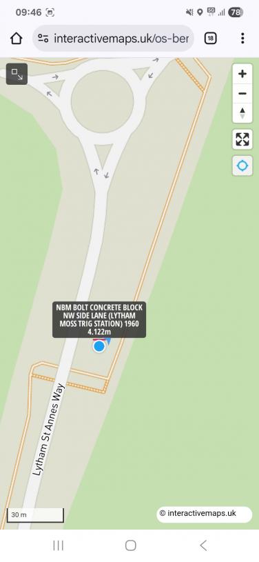 By Earby Rambler 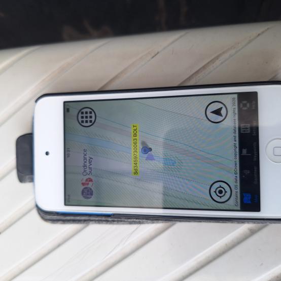 By Earby Rambler 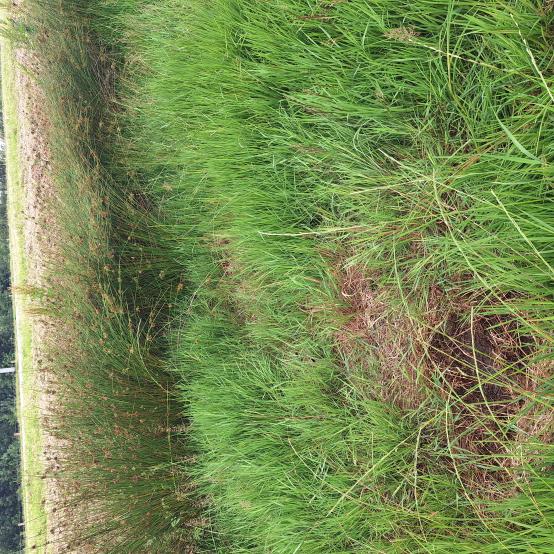 By Earby Rambler 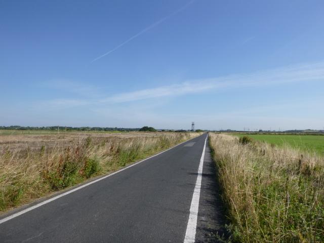 By Trigger See 3 more in the album. |
![]() 2nd Jul 2025 09:45 by Earby Rambler
2nd Jul 2025 09:45 by Earby Rambler
FB Number: Not logged Condition: Couldn't find it Score: 4/10
Arrived Lytham via 06.05 280 Earby to Preston 08.00 68 Preston to Blackpool Stagecoach buses. Easy walk up on Bridleways to the South, Moss Hall Lane & Sluice Lane. (Site access doesn't come much easier than this). Also on BMD as BOLT NBM BOLT CONCRETE BLOCK NW SIDE LANE (LYTHAM MOSS TRIG STATION) ODN 4.122m AGL -0.200m 1960
![]() Map Location
Map Location ![]() Site
Site ![]() Not shown on Master Map
Not shown on Master Map
![]() 6th Sep 2022 10:30 by Mickandkim
6th Sep 2022 10:30 by Mickandkim
Gridref: SD 34500 30000 FB Number: Not logged Condition: Inaccessible Score: 3/10
CFI Inaccessible due to new road construction Could be gone !
![]() 15th Aug 2016 09:35 by Trigger
15th Aug 2016 09:35 by Trigger
FB Number: Not logged Condition: Couldn't find it Score: 5/10
![]() 18th Jan 2014 12:30 by CJO
18th Jan 2014 12:30 by CJO
FB Number: Not logged Condition: Couldn't find it Score: 3/10
Had a prod about in the verge at the GR on the west side of the road, which is almost opposite an old large straining post. Road may have been made up as the verge has a thick pebble layer. Possibly lost due to burial, road widening (although it is very narrow as it is), or subsidence/flooding.
![]() 22nd Dec 2012 13:05 by lonesome_cowboy_burt
22nd Dec 2012 13:05 by lonesome_cowboy_burt
FB Number: Not logged Condition: Couldn't find it Score: 2/10
Miserable day, road busier than I expected. Poked about but found nothing. A couple of thousand Pink-footed Geese in adjacent fields
![]() 12th Nov 2012 14:44 by tigger4242
12th Nov 2012 14:44 by tigger4242
FB Number: Not logged Condition: Couldn't find it Score: 5/10
Could not find it on this occasion. Will look again when the grass is lower. Photo anyway
![]() ©tigger4242
©tigger4242
![]() 29th Jul 2012 12:06 by PeteBoggs
29th Jul 2012 12:06 by PeteBoggs
FB Number: Not logged Condition: Couldn't find it Score: 2/10
Found right spot with GPS just south of radar station but verges are very overgrown at present
![]() ©PeteBoggs
©PeteBoggs
![[map]](/img/trig-map.png.php?t=8392&b=2&l=0&)