Active station
Active Stations are GPS receivers which constantly write Receiver Independent Exchange Format (RINEX) data out to the Ordnance Survey OS Net website. The files are publically downloadable, and allow measurements taken in the field to be post-processed for greater accuracy.
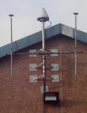
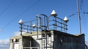
The Active Station network came online in early 2000. Most early stations were placed in pairs and had TRIMBLE 4000SSI receivers with conical antennae in small arrays, though freestanding Leica CRS1000 and Ashtech UZ-12 receivers were also used.
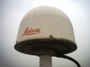
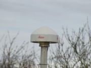
A major upgrade to the active network was started in December 2008 when most active stations were equipped with GNSS-enabled receivers with single dome-shaped antennae such as the Leica GRX1200 or AR25. More recently, the slimmer Leica AR10 has been installed, also the Trimble TRM55971 featuring a small flat plate. Since 2018, new Septentrio PolaRx5 receivers have been installed on some sites. The OS antenna offset page lists some current models.
Log files for current and discontinued stations are available from BIGF (British Isles continuous GNSS Facility) as is a map of current stations. Active stations maintained by bodies other than the Ordnance Survey, referred to as 'Scientific Stations', are also listed here. A summary of recent changes. is available.
As of June 2025 Trigpointing UK lists 196 Active Stations, approximately 25% of these are destroyed stations.
| T:UK | Station name | Location | Grid Ref | Status | Date | Notes |
|---|---|---|---|---|---|---|
| TP25845 | TAUO | Taunton | ST 24444 25397 | New | 2020-02-04 | Replaced earlier stations |
| TP25844 | EDIB | Edinburgh | NT 16115 71403 | New | 2021-06-22 | Replaced earlier stations |
| TP25761 | CATT | Catterick | SE 18525 97507 | Destroyed | 2022-01-31 | Catterick; replaced by CATE |
| TP25848 | CATE | Catterick | SE 17953 97410 | New | 2022-01-31 | Replacement for nearby station CATT |
| TP7277 | KING | Kings Lynn | TF 62181 19787 | Destroyed | 2022-02-01 | Kings Lynn (reported as destroyed on BIGF) |
| TP25857 | HART | Hartley Wintney | SU 76411 56368 | New | 2022-07-05 | Replacement for FARB |
| TP7770 | FARB | Farnborough | SU 85696 54136 | Destroyed | 2022-07-12 | Farnborough (redevelopment of the site); replaced by HART |
| TP7452 | WEAR | Wear Head | SW 92011 75380 | Destroyed | 2023-10-18 | 'Power cannot be restored so site effectively destroyed and data collection ended' (BIGF) |
| TP25944 | REDE | Redesdale | NY 82337 99022 | New | 2024-04-02 | Weather station compound |
| TP25943 | CHEW | Chew Magna | ST 56698 60802 | New | 2024-07-03 | Roof of Chew Valley Sailing Club at the W angle |
| TP7452 | PADT | Padstow | SW 92011 75380 | Destroyed | 2024-10-17 | 'Site destroyed' (BIGF); temporarily replaced by PAD2 |
| TP7753 | SWAS | Swansea | SS 62736 87048 | Destroyed | 2024-12-04 | Replaced by SWAE at a different site |
| TP25947 | SWAE | Swansea | SS 56888 91335 | New | 2024-12-06 | Swansea airport; replacement for SWAS |
| TP25946 | HAYD | Haydon Bridge | NY 84562 64505 | New | 2025-01-14 | Roof of Football Club; possibly a replacement for WEAR (Wear Head) |


